A flash flood typically starts less than six hours after a heavy downpour. This makes it very deadly, especially in low-lying areas. Mountainous streams, rivers, culverts, storm drains, and urban areas are most prone to flash flooding as well.
Although it’s usually characterized by roaring torrents that tear across riverbeds, city streets, or mountain valleys. It can also happen when there hasn’t been any rainfall. For example when a levee or dam fails or when ice or debris jams suddenly release water.
According to the National Weather Service, more people die from flooding than almost any other weather-related disaster. The majority of flood-related fatalities either take place at night or when people are trapped in stalled cars while traveling through flooded areas. “Turn Around, Don’t Drown” is the phrase used by the United States National Weather Service to advise individuals to leave the area of a flash flood rather than attempting to cross it.
People often underrate the risks posed by flash floods. Meanwhile, they’re particularly deadly due to their abrupt onset and swiftly moving water. People may become overconfident and less inclined to dodge the flash flood if they are in a car. Cars offer little to no protection against being swept away. More than half of the fatalities caused by flash floods are people submerged in cars while trying to cross a flooded area.
With the combination of the water’s strength and availability with daily life, flash floods pose a threat to people, private and public property, and the environment. The magnitude of each individual incident and the limited size of the affected area makes flash floods difficult to observe and report.
Every state and territory in the United States experiences flooding and the possibility of flooding exists everywhere there is rain. However, there’s been devastating flash floods in America’s history. Here are 10 of the deadliest flash floods in the United States.
Johnstown Flood, 1889
Everett Collection/Shutterstock.com
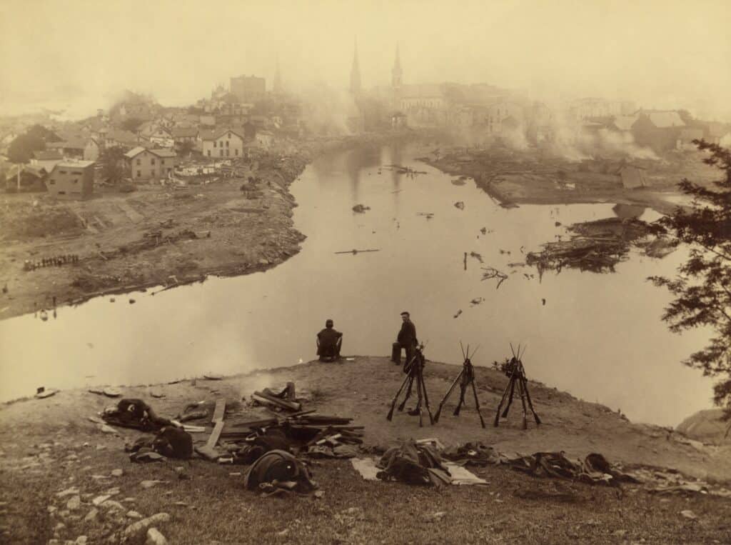
On May 31, 1889, Johnstown in Pennsylvania recorded the deadliest flash flood in U.S history. After about a week of storms and heavy rainfall, the South Fork Dam broke. It was situated on the south fork of the Little Conemaugh River, 14 miles (23 km) upstream of Johnstown, PA.
The breach caused the local reservoir, Lake Conemaugh, to release 20 million tons of water into the city of Johnstown. The flood, which briefly matched the average flow rate of the Mississippi River, led to the death of 2,209 people. It also caused $17 million in damage (figure not adjusted for inflation).
Heppner Flood, 1903
herr.geschichte, CC BY-SA 4.0 <https://ift.tt/UrEvSYA>, via Wikimedia Commons – License
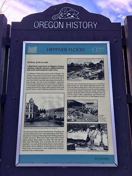
Eastern Oregon saw one of its warmest and driest springs ever in 1903. The residents of Heppner, OR were probably getting ready for family dinners or evening church services on Sunday, June 14. This happened to see just like another scorching day. In the hills southwest of the town, black clouds started to form by mid-afternoon.
Rain and hail followed at about 4:30 p.m. According to reports, people were unable to hear the wall of water and debris that plummeted through the town. This was due to the storm’s deafening noise.
A major flash flood on that fateful day, along Willow Creek, destroyed a substantial part of Heppner. The 247 fatalities make it the deadliest natural catastrophe to ever strike Oregon. It ranks second among U.S. flash floods in terms of fatalities. This flood is just ahead of the 1972 Black Hills Flood and behind the Johnstown Flood of 1889. The flood caused over 600,000 dollars in damages.
Black Hills Flood, 1972
Rapid Creek and other nearby streams experienced record-breaking flooding on June 9 and June 10, 1972. A result of very heavy rains that fell across the eastern Black Hills of South Dakota.
Around Nemo, more than 10 inches of rain poured over a 60 square mile region in the course of around 6 hours. The ensuing floods, according to the Red Cross, led to 238 deaths and 3,057 injuries. There was also an estimated $160 million in total damage, which involved 1,335 houses and 5,000 destroyed cars. Battle, Spring, Rapid, and Boxelder Creeks had record floods, as a result of runoff from the storm. Elk Creek and Bear Butte Creek were also affected by smaller floods.
The Black Hills Flood was the most destructive flood in the history of South Dakota. Also one of the deadliest ever recorded in the country.
Big Thompson Canyon Flood, 1976
Lvaughn7/Wikimedia Commons – License
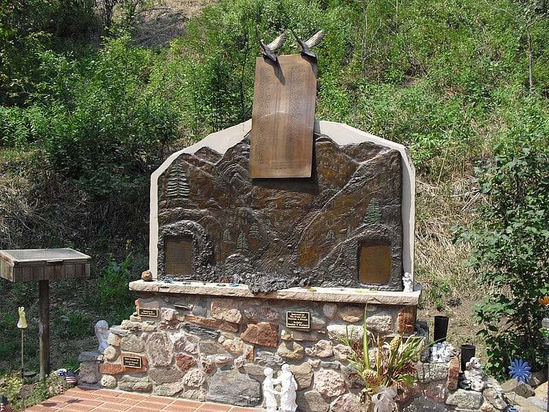
The deadliest natural catastrophe in Colorado history hit Big Thompson Canyon on July 31, 1976. It was the most powerful flood since glaciers retreated 10,000 years ago caused by clouds that were heaped 12 miles into the mountain sky.
This unfortunate incident took place on the eve of the state’s centenary celebration that lured outdoor lovers to Larimer County. There were reportedly 3,500 people fishing, camping, and enjoying themselves in the canyon when the tragedy struck.
It claimed the lives of 144 people. Officials never found five of the victims. Total damage estimates reached $35 million.
Although none has been as terrible as the 1976 flood, the area has had a number of flash floods. The canyon and many other areas of the Front Range and Eastern Plains were severely flooded in September 2013.
According to the United States Department of Agriculture, the 2013 flood devastated 14 counties, resulting in 10 deaths, 26,000 homes damaged, and 2,000 homes destroyed.
Shadyside Flood, 1990
The steep Appalachian valley of Belmont County had a deadly storm late on June 14, 1990. This was one of Ohio’s deadliest floods since 1969.
Earlier in the day, tropical air was coming northward from the Gulf of Mexico, saturating the soils with water after a very wet month. 5.5 inches of rain fell over the steep valleys and waterlogged soils along Pipe and Wegee Creeks. There were a whopping 3 to 4 inches falling in an hour. Most of the water flowed directly into the streams from the hillsides. This created a wall of water over six feet high as it went through the creeks.
Debris dams formed at bridges along the creeks. Trees, cars, and fallen buildings swept into the river, raising flood levels and producing stronger flows as the dams broke. The Shadyside flood left 26 people dead in its wake. It also damaged 250 houses and destroyed 80 others.
Texas Flood, October 1998
The Guadalupe River and the San Antonio metropolitan region in Southeast Texas saw devastating flash floods over the weekend of October 17–18, 1998. A result of two hurricanes over the Eastern Pacific and a cold front that was almost stationary.
Mid- to high-level moisture from the weakening remnants of Hurricane Madeline was traversing the Sierra Madre Occidental into central Texas when the morning of October 17 saw the start of heavy rains.
Nearly 20 inches (510 mm) of rain fell in some areas of Southeast Texas as a result of the storm, which also left behind over $1.19 billion in damages, making it one of the most expensive storms in American meteorological history. This storm caused the loss of 31 lives.
Arkansas Flood, June 2010
In the early hours of June 11, 2010, flash floods inundated the Albert Pike campground. The Little Missouri River rose more than 20 feet (6 meters) in a matter of hours due to torrential rains. Up to 4.7 inches of rain fell in the upper Little Missouri River basin in 3 hours, causing the flooding that led to 20 fatalities and significant property damage.
For a storm with a three-hour duration, the 4.7 inches of rain in three hours equates to an estimated annual exceedance likelihood of about 2%. In the upper Missouri River watershed, the maximum total estimated rainfall was 5.3 inches in 6 hours.
Five unmeasured and one gauged location in the upper Little Missouri River basin were used to assess peak streamflows and other hydraulic characteristics. Peak streamflow for the Little Missouri River in Albert Pike, AR, was estimated to have happened between 4:00 am and 4:30 am on June 11, 2010, and it was 40,100 cubic feet per second.
Nashville Flood, May 2010
KennStilger47/Shutterstock.com
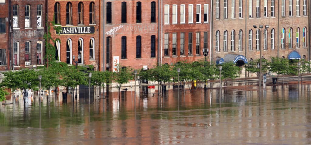
Middle Tennesseans will never forget the deluge of rain and devastation caused by the flooding from May 1 through May 3, 2010. Two days of consecutively record-breaking rainfall on May 1 and May 2 resulted in extensive flash floods and river flooding throughout most of the mid-state.
In Middle Tennessee alone, the storm claimed 18 lives, and at least 27 individuals died in Tennessee and Kentucky overall. As for the property damage, estimates are difficult to create and can be very different, but they amounted to billions of dollars and contributed to the need for a Presidential Disaster Declaration for numerous counties in West and Middle Tennessee. Multiple rounds of powerful thunderstorms exacerbated the situation. Some even resulted in significant wind damage and tornadoes.
Utah Flash Floods, 2015
U.S. Geological Survey/Flickr – License
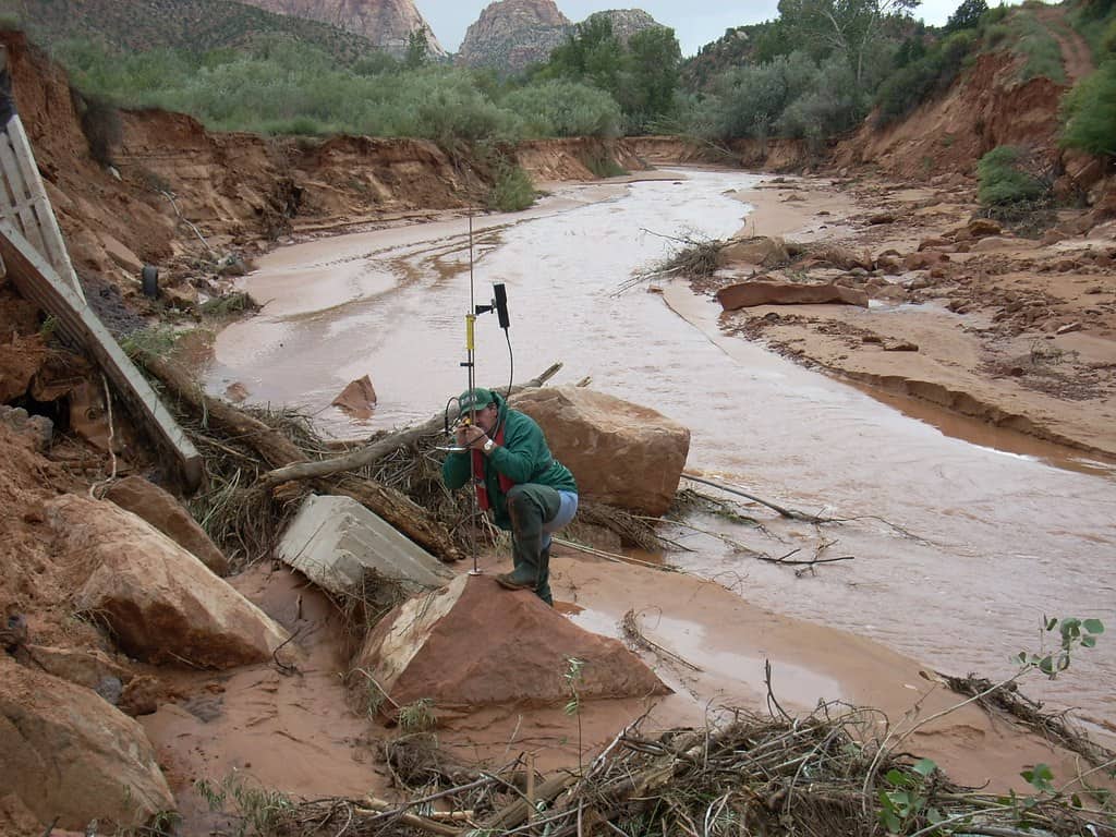
In just 30 minutes, an inch and a half of rain caused this severe flash flood. Residents were surprised when the murky water rushed fast down a gorge close to the border.
About 20 people lost their lives in the 2015 flood near the Utah-Arizona border, 13 of whom were in submerged cars while seven others were on a hike in Zion National Park.
Eastern Kentucky Floods, 2022
The National Guard/Wikimedia Commons – License
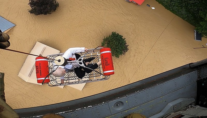
This has been described as America’s deadliest non-tropical flash flood in 45 years. A number of complex thunderstorms that formed south of I-64 unleashed torrential rain, severe flash floods, and catastrophic river flooding in eastern Kentucky and central Appalachia between July 25 and July 30, 2022.
These thunderstorms occasionally produced more than four inches of rain per hour across difficult terrain, which had a wide range of disastrous effects. Although it didn’t rain nonstop for the entire four days, the high volumes of rain and ensuing flooding resulted in 39 fatalities and extensive catastrophic damage. Flood waters washed away entire homes and portions of some communities, causing expensive damage to the area’s infrastructure.
Up Next…
Check out some of our other articles based on natural disasters.
- Why Do Plagues Of Snakes And Spiders Follow Floods – The real reason may surprise you.
- Which Countries Have The Most Hurricanes – You can be sure you avoid these during hurricane season.
- Which States Have The Most Hurricanes – Hopefully your hometown isn’t on this list!
The post The 10 Deadliest Flash Floods in the United States appeared first on AZ Animals.
from Animal News, Facts, Rankings, and More! - AZ Animals https://ift.tt/1HxXb2c